Sample Dataset for arcAstroVR
To run arcAstroVR, a Dataset containing topographic and archaeological data is required. To create your own Dataset, please use the QGIS Plugin for arcAstroVR terrain generation. The following sample datasets are available for checking the operation of arcAstroVR. For other publicly Datasets, see the list of Datasets on the Download page.
Note: The file format has been changed in arcAstroVR Ver.0.17. Please download and use the new format version when using the previous data.Around the numerous crosses engraved on the lid stone of the box-shaped sarcophagus tomb.
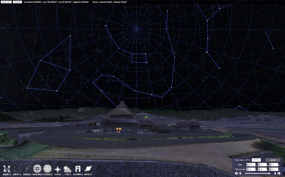
During the excavation of the Yoshinogari site in 2022, a box-shaped stone coffin tomb was discovered in a corner of a large-scale tomb area that has continued since the first half of the Middle Yayoi Period. The lid stone of the box-shaped stone coffin tomb is decorated with numerous engraved lines, and the hypothesis that these engraved lines are related to the starry sky of the past is being verified using simulations. It was shown at the Saga Yoshinogari Historical Park event "Yoshinogari: Echoes of Light" held in December 2024. This video will be presented at the 10th Archaeological Astronomy Conference held during the above event.
The Starry Sky as Seen by Himiko
- Sunrise and Moonrise Calendars as Revealed by Buildings -
Adding 3D data of the southern inner wall to the previous work, "The Starry Sky as Seen by Himiko - The Mystery of the Full Moon Climbing High -," this video examines the relationship between the buildings at the Yoshinogari Site and the sunrise and moonrise calendars. It was shown at the Saga Yoshinogari Historical Park event "Yoshinogari: Echoes of Light" held in December 2022. This video will be presented at the 6th Archaeological Astronomy Conference held during the above event.
The Starry Sky as Seen by Himiko
- The Mystery of the Full Moon Climbing High -
This video was shown at the Yoshinogari Historical Park event "Yoshinogari: Echoes of Light" held at the Yoshinogari Historical Park in Saga Prefecture in December 2021. The relationship between the Yoshinogari site and celestial navigation is verified by arcAstroVR. This video was presented at the "4th Archaeological Astronomy Conference" held during the above event.
